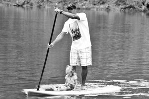
Paddle Boarding Tibble Fork Reservoir, Utah
- Written by Staff
- Published in Travel
- Comments::DISQUS_COMMENTS
Written by Andre Niemeyer
Tibble Fork Reservoir is a small body of water sitting at 6,300ft high at the heart of the American Fork Canyon.
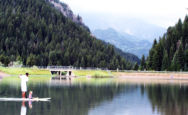
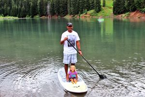
Stand Up Paddle Boarder paddling with family at Tibble Fork Reservoir in Utah Photo Courtesy: Supconnect.com.
Introduction
TIBBLE FORK RESERVOIR, Utah – Tibble Fork Reservoir is part of Uinta National Forest, which offers unrestricted access to visitors, who have to buy a $10 pass worth two days of access. The American Fork Canyon, carved out by the early runnings of glacial waters, offers a stunning view for stand up paddle (sup) boarders and their families. Although small, Tibble Fork Reservoir has several attractions aside from its stunning scenery. It can be used as a high-altitude lap course for those keen on racing, plus it has plenty of fishing and outing opportunities. Brown and rainbow trouts are a known catch and camping sites are available nearby. Water temperature is well below 50 degrees Fahrenheit, even later in the summer. There are running streams at the two ends of the reservoir, especially during early spring, which can make for a great upstream paddle workout along the water's edge.
Summary
| 1 | Season runs from Mid/Late Spring through Early Fall |
| 2 | About $10 fee required to enter Uinta National Forest |
| 3 | Fishing is known for its rainbow and brown trouts |
| 4 | Small body of water, water temp below 50F, and evelation 6,300ft. |
Seasons
|
Mid Spring thru Early Fall Water levels were unusually high late summer 2011 |
From mid/late Spring through early Fall (May-September) is your best chance to stand up paddle (sup) board the Tibble Fork Reservoir. Too early in the season, you run the risk of finding it frozen and too late you might find it dry. Given the small and fairly shallow body of water, combined with high altitude and cold waters, Tibble Fork can freeze quickly and completely shutdown the paddling window. And if wintertime is too dry, there is always the risk of finding it too shallow after springtime. (Join Destination Group.)
Remember
| 1 | Mid/Late Spring through Early Fall |
| 2 | Too early and water might be frozen |
| 3 | Too late and water might be too low |
Hot Spots
|
Streams |
||||||
The running streams are definitely worth checking out. Earlier in the Spring, you'll find much more water (cold! water and freshly melted from the glaciers) running into the reservoir at primarily two different points. The one at the northeast end has the most water and makes for some fun paddle exercise. You can get your race hat on and keep paddling to try to stay in the same place – kind of like a pool with running water workout. Or, if you want a bit more rush, you can hike upstream a bit and do a short down river right into the Tibble Fork Lake. The other stream, at the south end of the reservoir, can also offer some of the upstream paddle workout, but it moves a bit more slowly. |
||||||
|
HIGHLIGHTS
|
|
Beach |
||||||
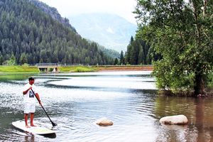
There are a few areas on the southeast end of Tibble Fork Reservoir that can resemble a beach – at least for those who have lots of imagination. Kids can play, daddy can fish, and mom can lay out her gear to setup basecamp for the family. It's relatively close to the parking lot, which is quite convenient for unloading the car. Here the shoreline is not as muddy as on other parts of the reservoir. If you are stand up paddle (sup) boarding close to the shore, be careful with slightly submerged rocks. If you hit one, it will likely launch you into freezing water. (Join Destination Group.)
|
||||||
|
HIGHLIGHTS
|
Other Paddlers
|
Tibble Fork Reservoir is in a National Forest, so you will not find a sup shop or any easily accessible stand up paddle facility nearby. However, Utah in general and Park City in particular is witnessing a burgeoning stand up paddle community, with enthusiasts ranging from fun-bent outdoorsmen, river rapids thrill seekers, and everything in between, including even some avid racers. Here are some of the references that come to mind. |
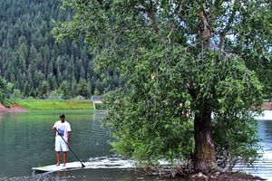
Nothing like paddling with friends and family |
||||
|
Contacts
|
|||||
More Photos
 |
 |
 |
 |
 |
 |
On Map
Directions
| 1 | Latitude and Longitude: 40.483254,-111.643889 |
| 2 | Google Map Address: American Fork Canyon Rd, Provo, UT 84604 |
| 3 | Driving Directions for Google Maps: Click Here to See Details |
| 4 | I-15 –> Exit 272 for UT-52 East –> Merge onto US-189 North –> Left on UT-92 |
© Copyrighted & Exclusive SupConnect.com Content

Staff
Submit your news, events, and all SUP info, so we can keep promoting and driving the great lifestyle of stand up paddling, building its community, and introducing people to healthier living.
Website: supconnect.com Email This email address is being protected from spambots. You need JavaScript enabled to view it.
